AggieAir Partners with UDWR, Forest Service, and GTAC to Aid in Recovery of Fishlake Streams
News Release — LOGAN, UT — March 11, 2019 — AggieAir recently partnered with the Utah Division of Wildlife Resources, Forest Service Fishlake National Forest, and Geospatial Technology and Applications Center (GTAC) to aid in the assessment and recovery of three streams within the Fishlake National Forest. These three streams, Seven Mile Creek, Lake Creek, and lower Fish Creek, have known water quality and fishery issues from past grazing, forest fires, and water management.

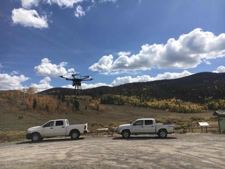
AggieAir UAV "Mantis" at Lake Creek in Fishlake National Forest, Utah.
This cooperative project aims to develop riparian land cover and in-stream feature maps based on high resolution aerial 4-band imagery. AggieAir completed the image acquisition and temperature sensor deployment with funding from the Utah Division of Wildlife Resources. The Forest Service Fishlake National Forest, Intermountain Regional Office and GTAC personnel completed the field and ground sampling and control point surveying and finally, the GTAC will assemble and finalize imagery analysis. The data gained from this partnership will result in models such as habitat maps, erosion maps, and an analysis of thermal imagery that will help the Forest Service assess current conditions and determine what additional recovery measures may be needed or desirable for the three streams.
This project and partnership is a natural expansion on work that AggieAir and the Utah Forest Service have completed in the past few years, most recently working together to map and treat the invasive aquatic weed (Eurasian watermilfoil) in Fish Lake, which is also in the Fishlake National Forest.
Fish Lake was first mapped in 2010 using data from satellite imagery. According to Fishlake National Forest Fisheries Biologist Jim Whelan, satellite data can cause issues if cloud cover or inclement weather make imagery unavailable. The use of AggieAir’s UAVs remote sensing capabilities solves this problem, and also provides much more detailed imagery for analysis. Mr. Whelan commented, “AggieAir is the best median remote sensing option available that’s able to get more detailed imagery than satellites while covering a wide swath of area.”
Each stream provided unique challenges for the AggieAir team in collecting the imagery. Seven Mile Creek is long at 6 miles and at a high altitude (9,000–10,000 feet). Lake Creek was also fairly high (8,800 feet) and was actively being grazed during the flight. Fish Creek was in rugged terrain with limited suitable launching and recovery sites, with an added hazard of rattlesnakes in the area. Despite the challenges, three flights were successfully completed in 2018. Imagery was then passed onto the GTAC who should complete their analysis and data modeling around August of this year.
Currently, preliminary results from this project are being presented at Utah’s fishery meetings in the hopes of expanding the use of remote sensing to aid in similar recovery efforts and other forestry applications.
AggieAir would like to thank the Utah Division of Wildlife Resources and the Forest Service for their help and contributions to this project.
Matrice Launching at Lake Creek
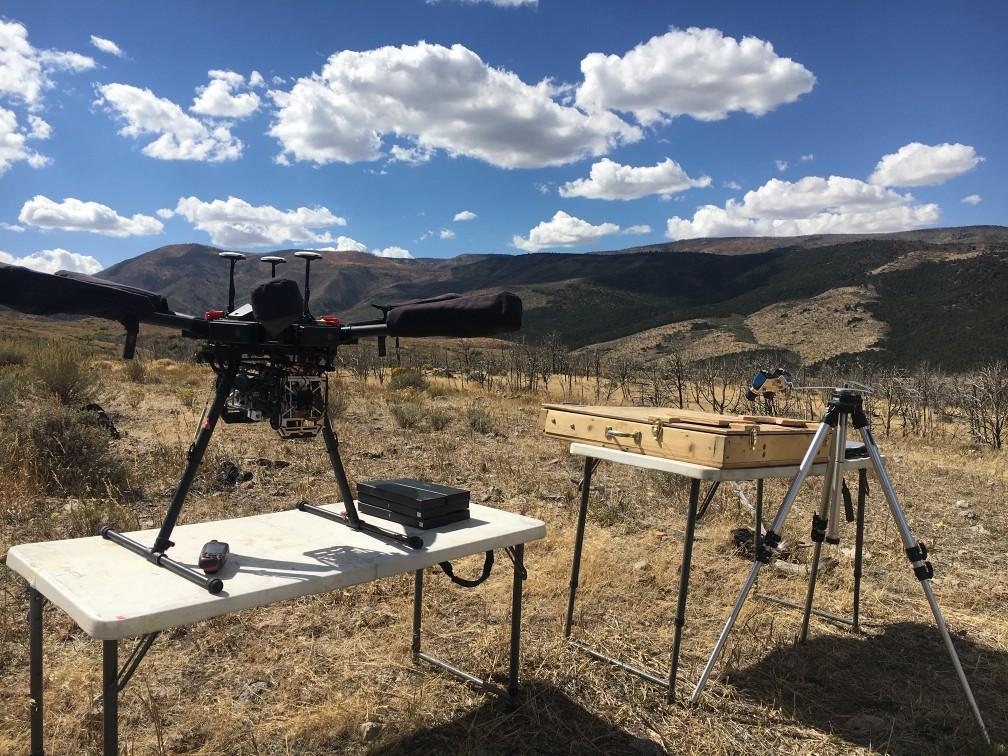
Matrice Preparing to Launch at Fish Creek

Fish Creek in Fishlake National Forest

Thermal Imagery from Fish Creek

RGB Imagery from Fish Creek

Color IR Zoom for Fish Creek
###
Researcher Contact: Ian Gowing | ian.gowing@usu.edu | 435-797-3159
Media Contact: Brittanie Carter | brittanie.carter@usu.edu | 435-797-7176